Scholar of the Wild
Geospatial work · Daniel Lott

Maps & Spatial Inquiry

My GIS work brings together archaeology, environmental questions, and campus mapping. This collection presents existing maps and a research poster; further examples and revised editions will be added as the work develops.

Cannabis in Archaeology — China

Archaeological locations and Silk Road routes shown alongside soil pH ranges.
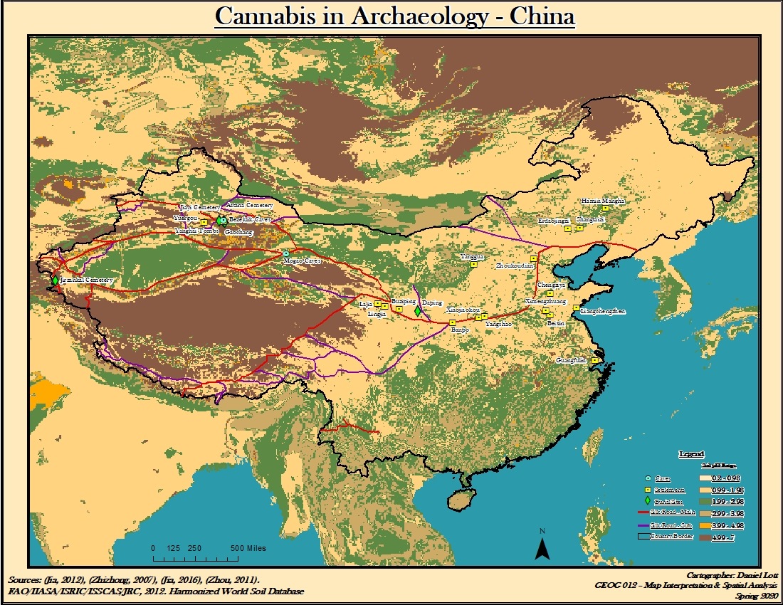
Cannabis in Archaeology — China. Full map layout with its original labels, legend and credits.
Open larger image: Cannabis in Archaeology — China

Cannabis in Archaeology — Central Asia

A companion map extending the geographical view into Central Asia.
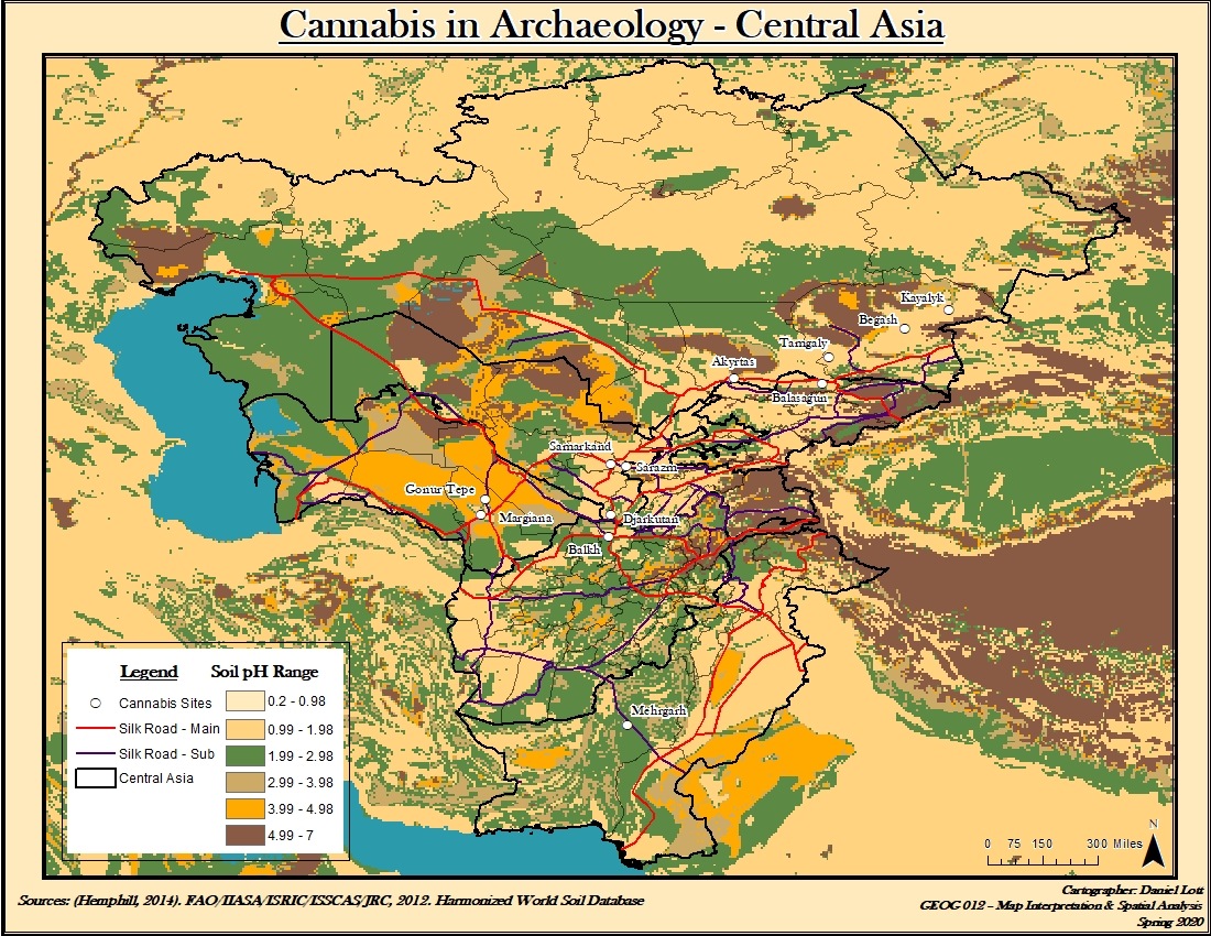
Cannabis in Archaeology — Central Asia. Full map layout with its original labels, legend and credits.
Open larger image: Cannabis in Archaeology — Central Asia

Midwest Watershed Saturation

A coursework map of watershed saturation, with streams and water stations.
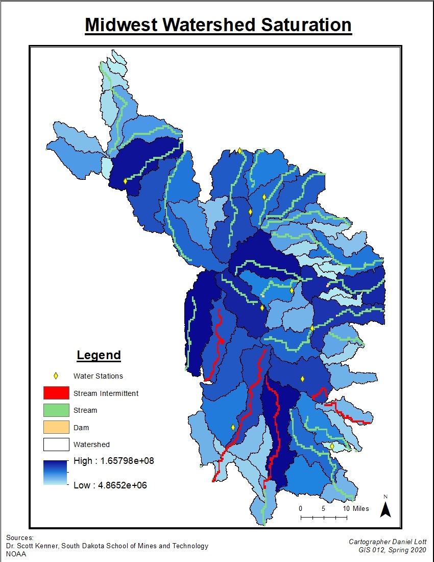
Midwest Watershed Saturation. Full map layout with its original labels, legend and credits.
Open larger image: Midwest Watershed Saturation

PCC Commons — Problem Overview

An annotated aerial overview of the Pasadena City College Commons.
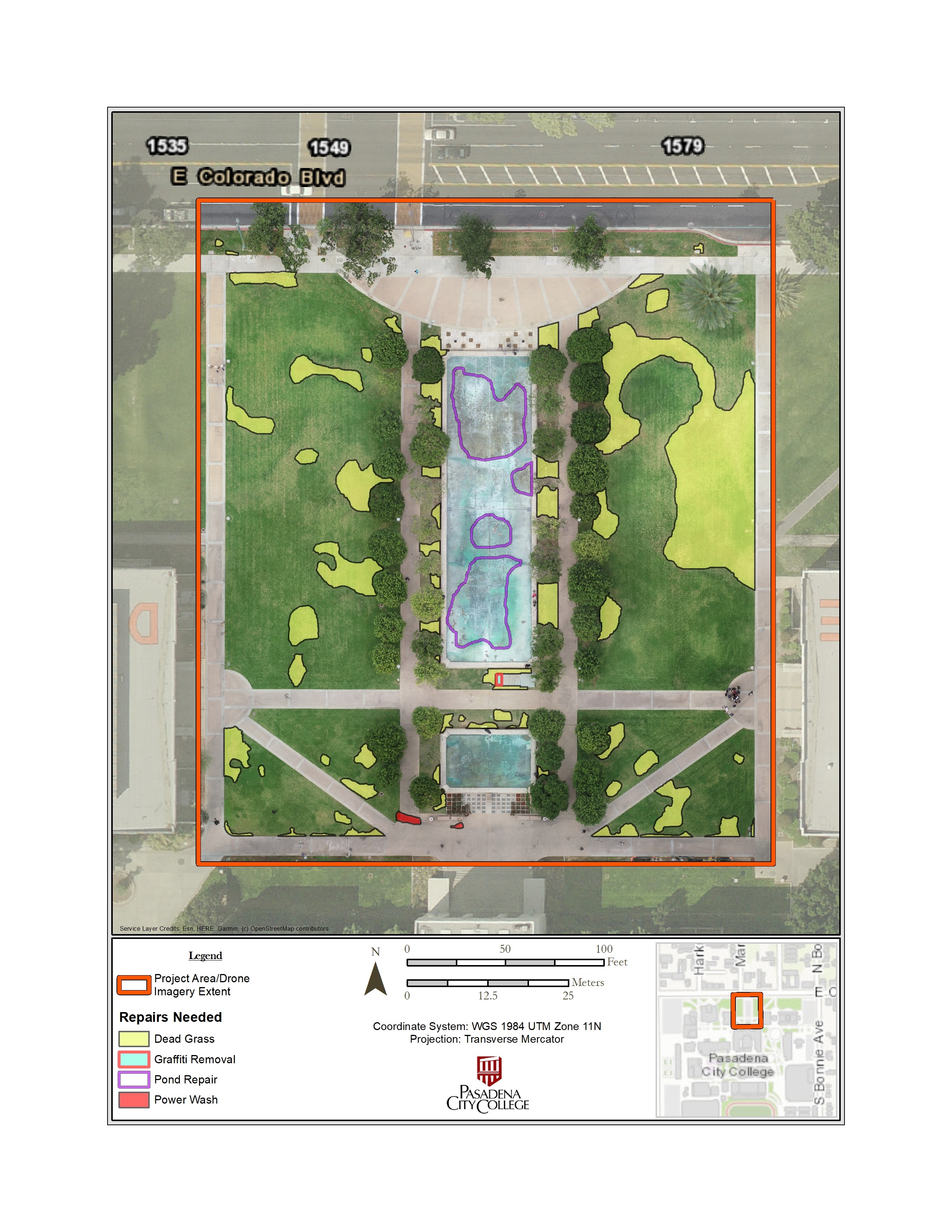
PCC Commons — Problem Overview. Full map layout with its original labels, legend and credits.
Open larger image: PCC Commons — Problem Overview

Cannabis in Archaeology — Research Poster

A research poster combining maps, text, and figures.
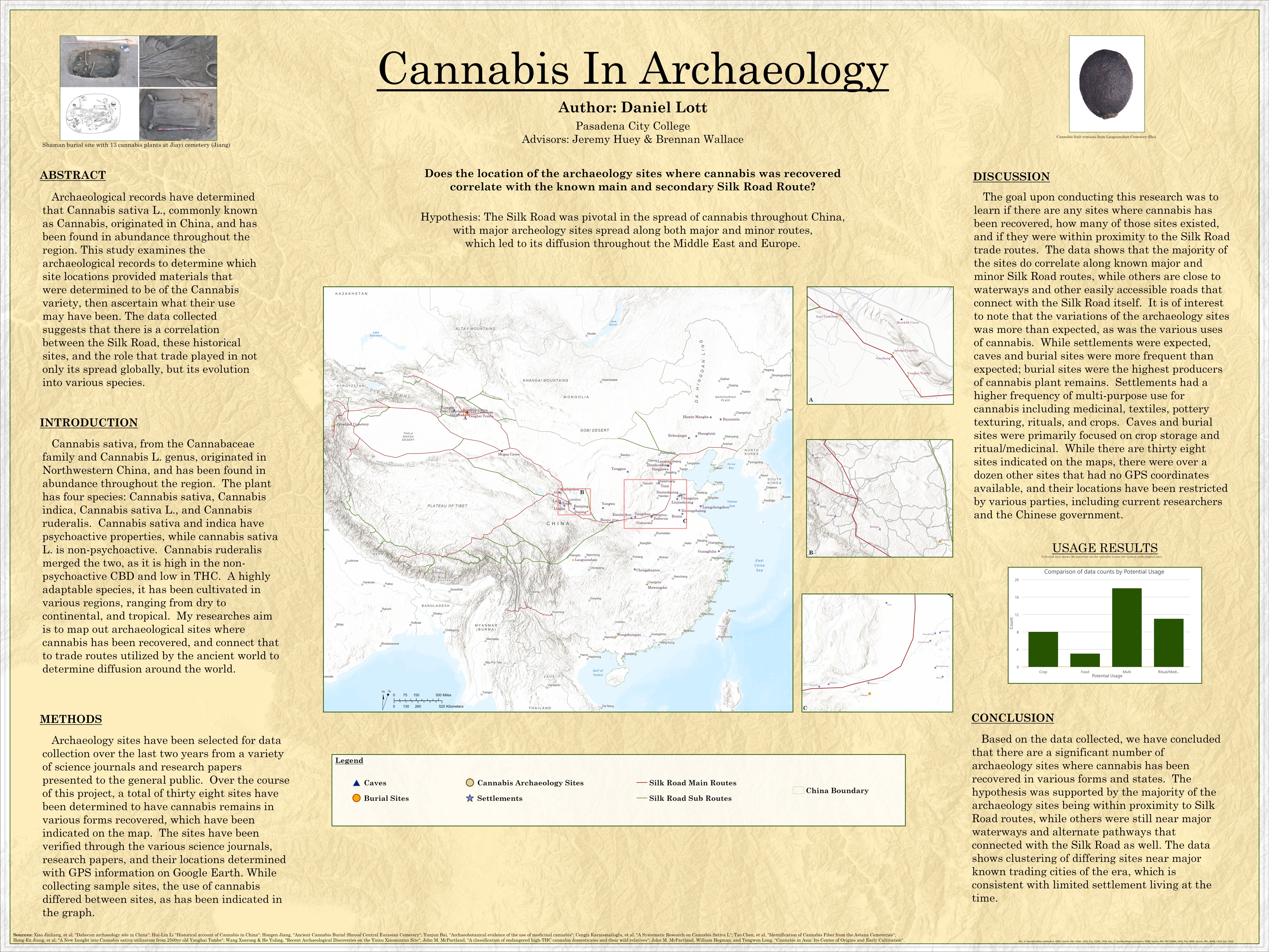
Cannabis in Archaeology — Research Poster. Full map layout with its original labels, legend and credits.
Open larger image: Cannabis in Archaeology — Research Poster
← Return to the work